Live Camera Feeds


Live from Iceland (Opens in New Tab)


Icelandic Volcanic Eruptions More


Fire & Iceland Documentary More


Reykjanes 3D Earthquake Chart (Past 48 Hours)
Hours Since Earthquake
0-4
4-8
8-12
12-24
24-36
36+
24
Custom Range
Plot
Bubble
Loading...
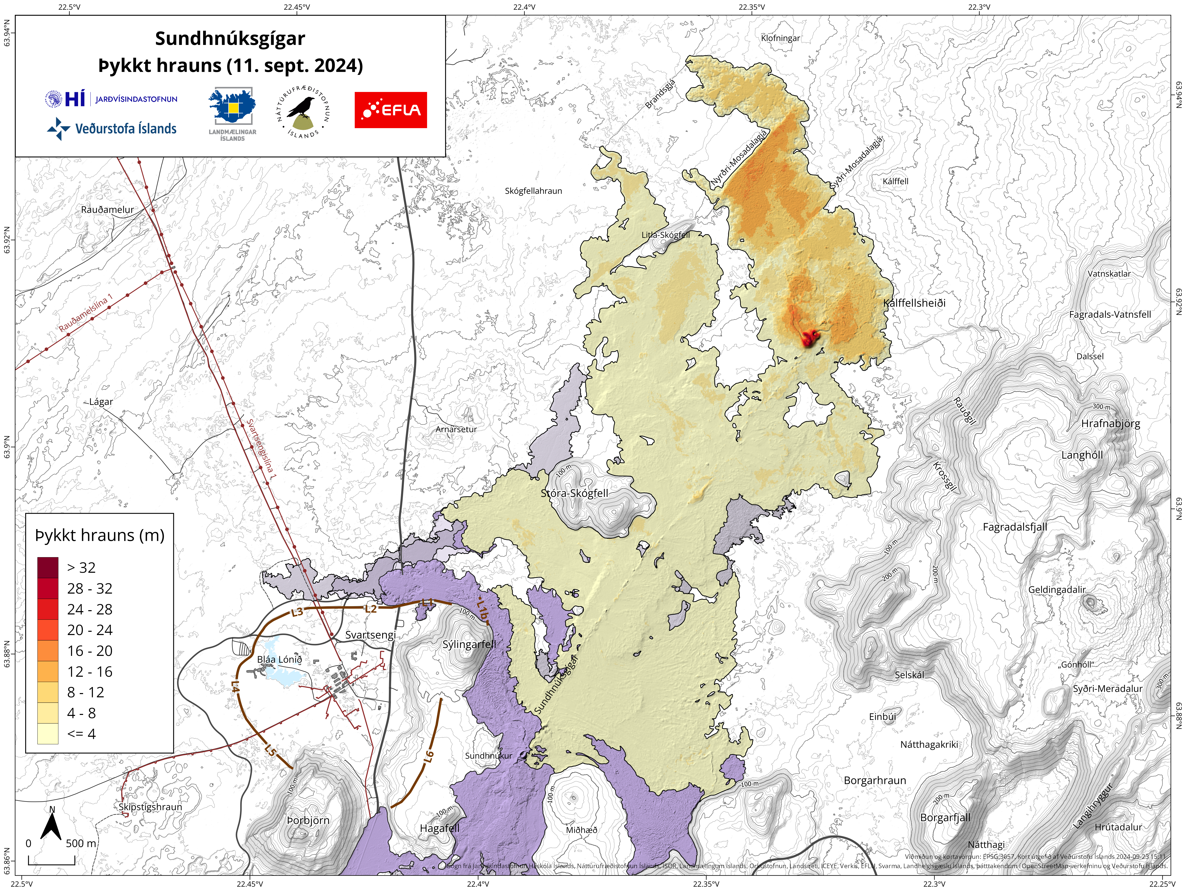
Current Lava Coverage (Updated August 25th)
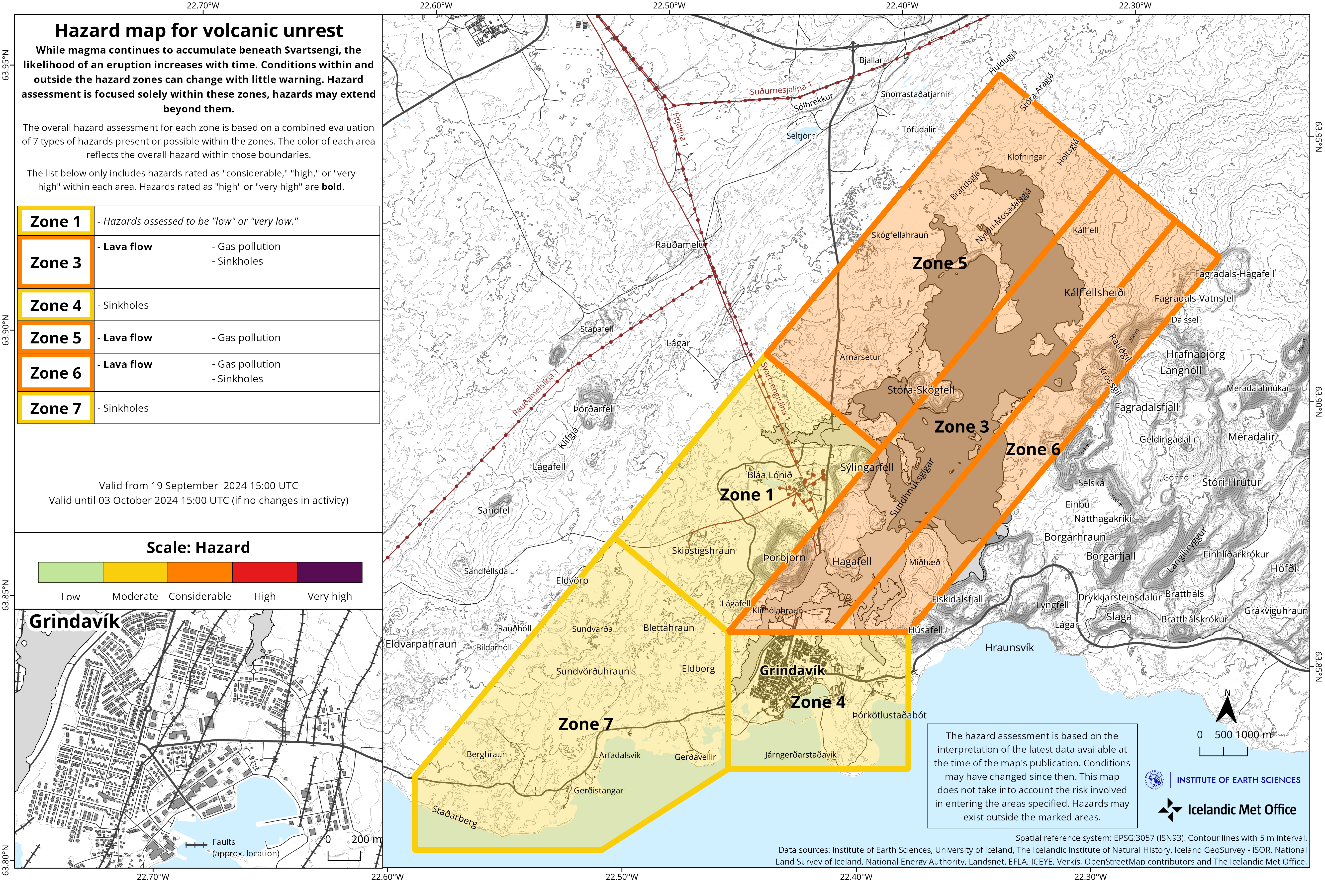
Current Hazard Zones (Updated August 26th)
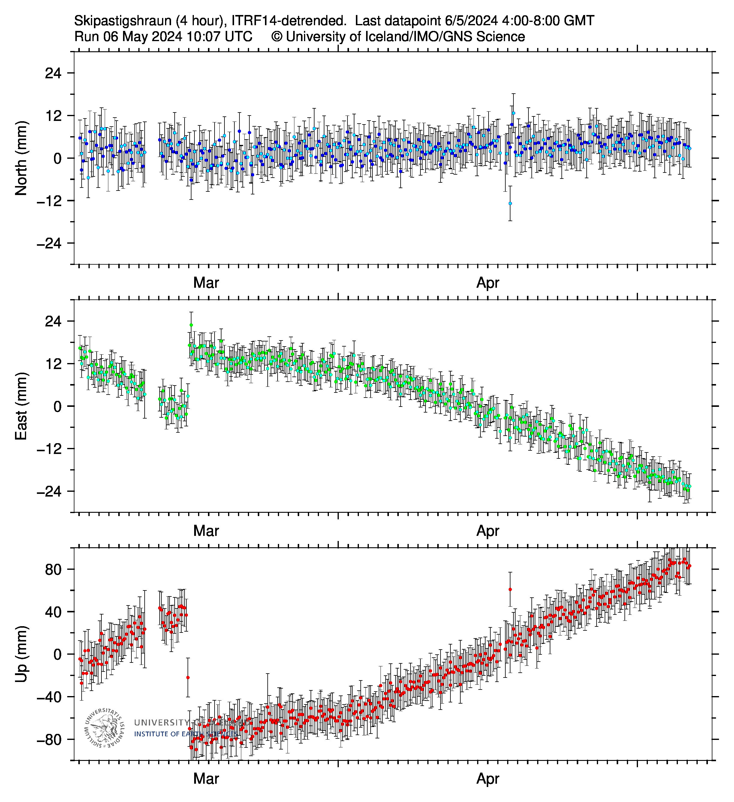
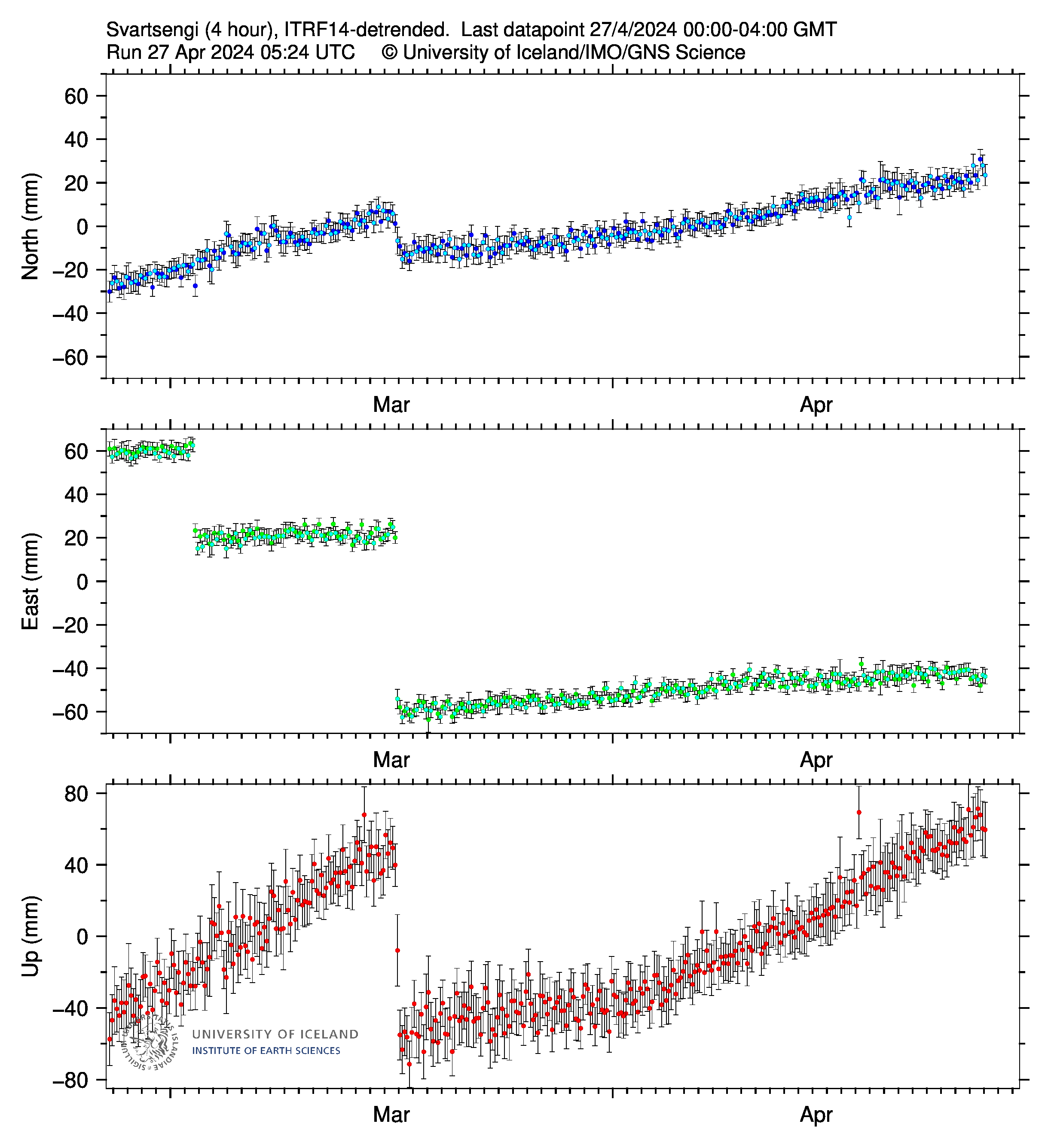
Crustal Deformation (SKSH / SENG)
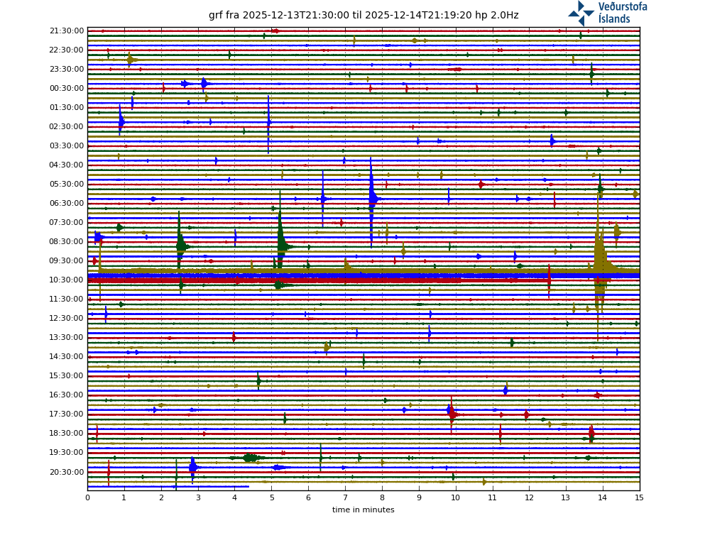
Harmonic Tremor Readings at Grindavik
Harmonic Tremor Readings Grímsfjall
Earthquake Depth Chart ()
Reykjanes Peninsula
Katla
Askja
Grímsfjall
Öræfajökull
Bárðarbunga
Grimsey
Label: (Hrs,Depth,Mag)
Icelandic Earthquakes (Last 24 hrs)
Hours Since Earthquake
Click Below to Adjust
Click Below to Adjust
0-4
4-8
8-12
12-24
24-36
36+
Detailed Earthquake Data
Mag 3+
Mag 2+
Mag 1+
Current Solar Data
Aurora Forecast

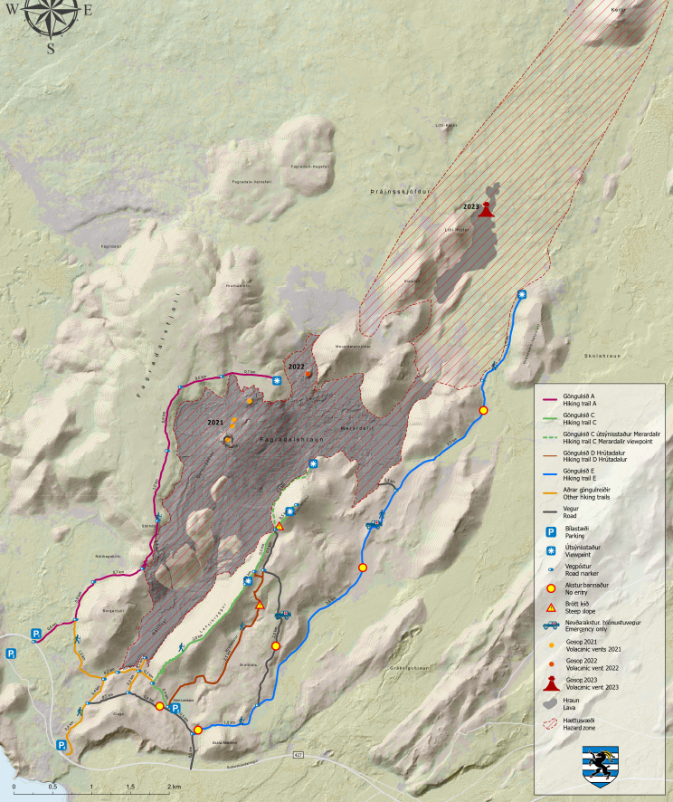
Area Walking Map
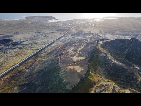
3D Map of 2024 Eruption
3D Map of 2023 Eruption Site
3D Map of 2021 / 2022 Eruption Site
Subscribe
Travel & Safety Information
Safe Travel Iceland
Icelandic Road Conditions
Icelandic Weather Service
Iceland Air Website
Play Airlines Website
Current Weather
Select Location
Forecast Weather

